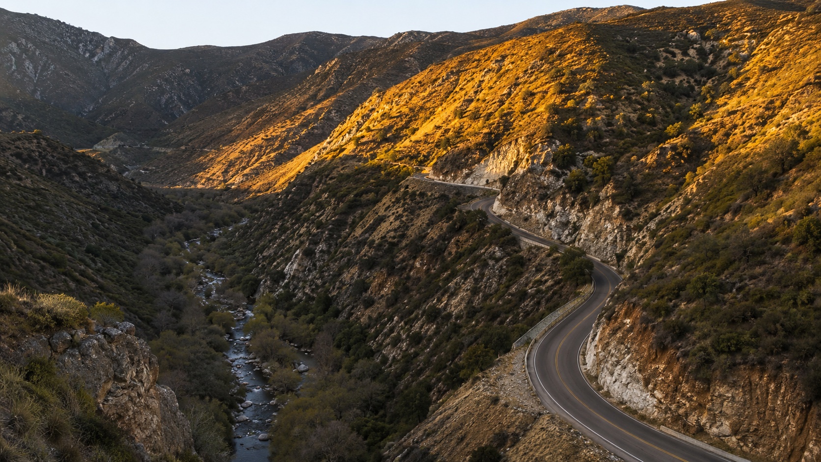
Big Tujunga Canyon is one of the deepest, most rugged canyons in the San Gabriel Mountains, and one of the most misunderstood pieces of public land near Los Angeles. People confuse the canyon with the creek. They confuse the lower road with the upper road. They show up expecting a lake and find a sediment-filled flood-control reservoir. They drive out for a waterfall and discover the last stretch involves a rope and a 40-foot drop.
This guide fixes all of that. It covers where the canyon is, how to confirm the road is open before you drive up, where to hike and picnic, when the creek and waterfalls actually flow, and what you need to know to visit safely.
Big Tujunga Canyon Conditions at a Glance
Mountain roads change fast. Weather, fire, rockfall, and debris flows can close Big Tujunga Canyon Road with little warning, so treat any status you read online, including this one, as a starting point rather than a guarantee.
Status module (verify before you go):
- Big Tujunga Canyon Road: [OPEN / CLOSED]
- Upper Big Tujunga Canyon Road: [OPEN / CLOSED]
- Fire-danger level: [CURRENT LEVEL]
- Trail or recreation-site closures: [NONE / LIST]
- Last verified: [DATE AND TIME]
Check these official sources before every trip:
- Angeles National Forest current conditions (U.S. Forest Service)
- Angeles National Forest alerts and notices
- LA County road-closure information
- National Weather Service mountain forecast
- Caltrans QuickMap for connecting state highways
As of the Forest Service’s most recent update, both Big Tujunga Canyon Road and Upper Big Tujunga Canyon Road were reported open. The agency cautions that mountain-road conditions can shift suddenly. A timestamped check beats an evergreen assumption every time.
What Is Big Tujunga Canyon?
Big Tujunga Canyon is a rugged canyon and recreation corridor in the San Gabriel Mountains, northeast of the Sunland-Tujunga community of Los Angeles. Big Tujunga Canyon Road runs through the lower canyon inside Angeles National Forest, passing creek-access areas, trailheads, and Big Tujunga Dam before meeting Angeles Forest Highway. The canyon holds Big Tujunga Creek, a year-round stream, along with hiking trails, picnic sites, and some of the best canyon scenery in the front range of the San Gabriels.
This is public land managed by the Forest Service, not a national or state park. That distinction changes the rules on passes, hunting, target shooting, and camping, and it comes up throughout this guide.
Big Tujunga Canyon Quick Facts
| Detail | Information |
|---|---|
| Location | San Gabriel Mountains, northeast of Sunland-Tujunga, Los Angeles County |
| Land manager | U.S. Forest Service (Angeles National Forest) |
| Main road | Big Tujunga Canyon Road |
| Western entrance | Near Oro Vista Avenue, Sunland |
| Eastern terminus | Junction with Angeles Forest Highway (N3) |
| Road surface | Paved, winding two-lane mountain road |
| Approximate drive length | Roughly 10 miles through the lower canyon |
| Best seasons | Spring for water and greenery, fall for cooler temperatures |
| Main attractions | Scenic drive, Big Tujunga Creek, Trail Canyon Falls, Big Tujunga Dam |
| Day-use requirement | Adventure Pass or America the Beautiful Pass at developed sites |
| Restrooms | Vault toilets at developed picnic sites |
| Potable water | None. Bring your own |
| Cell reception | Spotty to nonexistent in the canyon |
| Dogs | Allowed, leashed at recreation sites |
| Swimming | Creek access at Wildwood and Stoneyvale, seasonal and unguarded |
| Camping | No casual roadside camping. Verify current rules |
| Main hazards | Flash floods, rockfall, fast traffic, slippery waterfall rock, fire closures |
Where Is Big Tujunga Canyon?
Location Within Los Angeles County
The canyon sits northeast of the Los Angeles neighborhoods of Sunland and Tujunga, climbing from the edge of the San Fernando Valley into the San Gabriel Mountains. Most of it lies within Angeles National Forest.
Three points clear up the geography that trips people up:
- Tujunga is a community within the City of Los Angeles, part of the official Sunland-Tujunga community-plan area.
- Big Tujunga Canyon extends well past the developed neighborhood into national forest and unincorporated mountain terrain.
- Angeles National Forest is a national forest, not a national park. The rules differ.
That last point matters for anyone searching whether park rules apply here. They do not. Forest Service regulations govern this land.
Big Tujunga Canyon vs. Big Tujunga Creek
The canyon is the landform. Big Tujunga Creek is the waterway that carved it and still runs along its floor.
The creek begins high in the San Gabriel Mountains and flows generally westward. It moves through the upper canyon, into Big Tujunga Reservoir behind Big Tujunga Dam, then continues down the lower canyon. Below the mountains it becomes Tujunga Wash and eventually reaches Hansen Dam. Major tributaries feeding the system include Mill Creek, Trail Canyon Creek, and Clear Creek.
One practical takeaway: the creek flows year round, but the volume swings hard by season. That single fact drives most of the decisions in this guide, from waterfall timing to swimming safety to flash-flood risk.
Big Tujunga Canyon Road vs. Upper Big Tujunga Canyon Road
These are two different roads. Confusing them can wreck a trip plan.
- Big Tujunga Canyon Road runs from near Oro Vista Avenue in Sunland east to Angeles Forest Highway (N3). This is the lower-canyon drive with the creek access, the dam overlook, and the main trailheads.
- Upper Big Tujunga Canyon Road is a separate mountain connector higher in the range, linking Angeles Forest Highway with Angeles Crest Highway (State Route 2).
- Angeles Forest Highway (N3) is the through-route connecting the canyon toward Palmdale and the Antelope Valley.
- Tujunga Canyon Boulevard is an urban street down in Tujunga. It is not the canyon drive, despite the similar name.
Because the lower road can be open while the upper road or a connecting highway is closed, anyone planning a loop or approaching from the high country needs to verify the entire route, not just one segment.
Is Big Tujunga Canyon Road Open Today?
How to Verify Current Road Status
Check in this order:
- LA County road-closure information for the canyon road itself.
- Angeles National Forest current conditions and alerts for forest-wide closures.
- Caltrans QuickMap for connecting sections of Angeles Crest Highway.
- The National Weather Service mountain forecast for incoming storms.
- Recheck after any storm or during any active fire in the range.
Why Big Tujunga Canyon Road Closes
The road shuts down for a predictable set of reasons:
- Wildfires and active firefighting operations
- Flash flooding and debris flows
- Mudslides and rockslides
- Storm damage to the roadbed
- Snow or ice at higher connecting elevations
- Emergency operations
- Reservoir and dam construction activity
Does “Open” Mean the Whole Route Is Open?
No. Big Tujunga Canyon Road can be open while Upper Big Tujunga Canyon Road, Angeles Forest Highway, or parts of Angeles Crest Highway stay closed. If you are approaching from Palmdale or planning a loop back through the high country, confirm every segment. A single closed connector can strand you or force a long backtrack.
Planning a Visit to Big Tujunga Canyon
Best Time of Year
| Season | What to Expect |
|---|---|
| Winter | Cooler hiking, but storms can bring road damage and dangerous creek flow. Water crossings get risky. |
| Spring | The sweet spot. Green hillsides, wildflowers, strong creek flow, and the best chance of a full Trail Canyon Falls. |
| Summer | Hot and dry, with elevated fire danger and weak or dry waterfall flow. Exposed trails become punishing by midday. |
| Fall | Cooler and pleasant, though water runs low and wildfire risk lingers well into the season. |
How Much Time to Allow
- Scenic drive only: 45 to 90 minutes
- Drive plus a creek picnic: 2 to 3 hours
- Drive plus a real hike: Half to full day
What Kind of Vehicle Do You Need?
The main canyon road is paved and fine for an ordinary passenger car when it is officially open. Plan for mountain-driving realities:
- Winding pavement and blind curves
- Occasional rockfall and debris on the roadway
- Fast commuters and recreational drivers, especially on weekends
- Limited shoulders and few pullouts
- Sparse services
- Gates on side forest roads that may be locked
Fuel, Food, Water and Cell Service
Prepare before you leave the valley:
- Fuel up before entering the canyon
- Carry more drinking water than you think you need
- Download offline maps. Cell service is unreliable
- Tell someone your route and expected return
- Pack basic roadside and first-aid gear
Big Tujunga Canyon Scenic Drive
The drive works best west to east, starting in Sunland and climbing into the forest.
Starting at Oro Vista Avenue and Sunland
The canyon begins where the Sunland neighborhood gives way to national forest near Oro Vista Avenue. This is your last convenient stop for fuel, food, and water. Keep speeds and noise down through the residential edge before the road climbs into the mountains.
Trail Canyon and the Waterfall Trailhead
A few miles up, a side road leads toward the Trail Canyon trailhead, the launch point for the Trail Canyon Falls hike. Parking sits near the bottom of the access road, and navigation apps sometimes give confusing or incorrect directions to it. Know the turn before you lose cell service.
Lower-Canyon Creek Access and Picnic Areas
The lower canyon holds the developed creek-access sites:
- Wildwood Picnic Site, with creek access and a trailhead for Stone Canyon
- Stoneyvale Picnic Site, with creek access and the approach to Grizzly Flats
- The Vogel Flat area, a name you will see spelled “Vogel Flat” and “Vogel Flats” across older listings
These sites run on day-use hours and require a pass. Facilities are basic: vault toilets, no drinking water.
Big Tujunga Dam and Reservoir Overlook
Farther up, an overlook gives you a view of Big Tujunga Dam and its reservoir. Use the legitimate turnout rather than stopping in the roadway. Do not treat the reservoir as a recreation lake. It is a flood-control and water-management facility, often heavy with sediment, and not a swimming or boating destination.
Big Tujunga Canyon Bridge and Mountain Views
The canyon bridge offers dramatic views, but it is not a safe place to stop or stroll. Photograph from designated pullouts and stay out of the travel lane. The drop and the traffic are both serious.
Junction With Angeles Forest Highway
The lower road ends at Angeles Forest Highway (N3). From here you can:
- Return the way you came, back toward Sunland
- Continue toward Angeles Crest Highway for a longer mountain loop
- Head toward Monte Cristo, Mill Creek Summit, or the Antelope Valley
Before committing to a loop, confirm that the connecting roads are open. A closure up high can turn a scenic loop into a dead end.
Best Things to Do in Big Tujunga Canyon
Hike to Trail Canyon Falls
This is the signature hike of the canyon, and the one most misrepresented online.
- Distance: Roughly two miles to the falls overlook from the trailhead
- Elevation gain: Moderate, with a steady climb
- Difficulty: Moderate to the overlook
- Stream crossings: Several. Expect wet feet, and expect them to be dangerous during high flow
- Shade: Mixed, with exposed stretches
- Waterfall flow: Strong in spring, weak to dry by late summer
The Forest Service describes the falls as about two miles from the trailhead and warns hikers to stay on the designated trail and use caution on slippery rock near the water. Reaching the overlook above the falls is a reasonable moderate hike.
Getting down to the base is a different matter. That final descent is steep and hazardous, and some online accounts casually describe using fixed ropes to reach the canyon floor as if it were routine. Treat those ropes as unverified and the descent as genuinely dangerous. This is not a maintained, railed viewpoint at the base, and it is not casual “rappelling.” If you are not equipped and experienced, enjoy the falls from the overlook and turn around.
Stone Canyon Trail From Wildwood
Stone Canyon Trail leaves from the Wildwood area and climbs toward Mount Lukens, the highest point within the City of Los Angeles. It is a demanding route, primitive in spots, and far more serious than a casual creek visit. Verify current trail conditions before committing, and treat it as a hike for experienced, well-prepared hikers.
Grizzly Flats Trail From Stoneyvale
The Grizzly Flats route begins near Stoneyvale and involves creek crossings and some route-finding. Seasonal water levels dictate how hard the crossings are, and conditions change with weather and fire recovery. This is another one to check on before you go rather than assume.
Condor Peak and the Vogel Flat Area
Condor Peak is a strenuous, exposed climb with limited shade and a trailhead that can be hard to spot. This is not a family outing. Bring offline navigation, plenty of water, and sun protection, and be honest with yourself about your fitness and experience.
Big Tujunga Narrows
The Narrows is an advanced canyon route, not a standard trail. It can involve scrambling, technical obstacles, and swimming through pools depending on water level. Flash-flood risk here is real and can be lethal. Reaching water at one point does not mean a safe walkable route continues along the entire creek. Non-canyoneers should identify a turnaround point and use it.
Creekside Picnicking and Swimming
The most common question about the canyon: can you swim in Big Tujunga Creek?
The Forest Service lists swimming access to the creek at both Wildwood and Stoneyvale. Keep these realities front of mind:
- This is a natural creek, not a lifeguarded pool
- Conditions vary enormously by season
- Never enter during high flow, thunderstorms, posted closures, or questionable water
- Do not drink untreated creek water
The developed sites generally run day-use hours in the range of 6 a.m. to 10 p.m., with creek access, vault toilets, no potable water, and a required Adventure Pass or America the Beautiful Pass. Confirm current hours and pass requirements on the official site pages before you go.
Cycling and Motorcycling
The canyon road is a well-known cycling and motorcycling route, prized for its curves and scenery. It also carries fast traffic, blind turns, narrow shoulders, and rockfall. Ride it early to dodge commuter traffic, and check road status before setting out. The same closures that stop cars stop bikes.
Wildlife Watching and Photography
The creek corridor supports riparian habitat, native birds and fish, and larger wildlife including black bears, coyotes, and rattlesnakes. Spring brings wildflowers. Burn scars from past fires tell the story of the canyon’s fire-and-recovery cycle. Photograph ethically, keep your distance from wildlife, and stay out of sensitive habitat.
Picnic Areas, Parking and Facilities
| Location | Best For | Creek Access | Toilets | Potable Water | Pass | Trail Access |
|---|---|---|---|---|---|---|
| Wildwood | Accessible picnicking and creek access | Yes | Vault | No | Required | Stone Canyon |
| Stoneyvale | Creek access and Grizzly Flats approach | Yes | Vault | No | Required | Grizzly Flats |
| Vogel Flat area | Trail access and historical place-name searches | Verify | Verify | No | Verify | Condor Peak and nearby routes |
| Trail Canyon Trailhead | Waterfall hiking | Along trail | Verify | No | Verify | Trail Canyon Falls |
Note that “Vogel Flat,” “Vogel Flats,” “Stoneyvale,” and older picnic-area names get used inconsistently across the web. Trust current signs and Forest Service status over obsolete online listings.
Big Tujunga Dam and Reservoir
What the Dam Does
Big Tujunga Dam is a flood-control and water-management structure. Its jobs include:
- Flood control for downstream communities
- Stormwater capture
- Groundwater recharge
- Flow management tied to habitat downstream
- Working in concert with Hansen Dam farther down the system
Why the Reservoir Fills With Sediment
Wildfire strips vegetation from the surrounding watershed. When storms follow a burn, they wash enormous volumes of loosened soil and rock downstream, and much of it settles in the reservoir. Over time this dramatically reduces the reservoir’s capacity and forces periodic sediment removal.
Big Tujunga Reservoir Restoration Project
Dated update (verify against the official project page): Current plans point toward a project bid period in summer 2026, site preparation in late 2026, and sediment-removal work beginning tentatively in spring 2027. The project background notes that the 2009 Station Fire burned a large majority of the contributing watershed, and that later storms deposited well over a million cubic yards of sediment into the reservoir.
Because timelines like this shift, confirm the current schedule on the LA County Public Works project page before relying on these dates. During active work, expect possible effects including construction noise, truck traffic, altered access at turnouts, changed views, and temporary closures.
History of Big Tujunga Canyon
Tongva History and the Name “Tujunga”
The canyon lies within the ancestral lands of the Tongva people, and the name Tujunga traces to Indigenous roots, often linked to a form such as Tuxunga. The full etymology deserves more than a throwaway line, and it deserves a qualified tribal or academic source. Rather than stamp a definitive origin here, treat the name as a reminder of the long Indigenous presence in these mountains and verify specifics against authoritative sources before repeating them.
Ranching, Mining and Early Canyon Access
Euro-American use of the canyon included ranching and mining in the nineteenth and early twentieth centuries. Early settlers such as Silas Hoyt established a presence here, and the earliest road access grew out of that period of ranching and resource activity.
Construction of Big Tujunga Canyon Road
A rough timeline of the road:
- Earliest sections date to the late nineteenth century
- The road reached the dam area in 1931
- A connection to Angeles Forest Highway followed in 1958
- Later work extended access toward Oro Vista Avenue
- Some proposed state-highway plans for the corridor were never built
Floods, Hansen Dam and the 2009 Station Fire
The modern canyon was shaped by disaster as much as by construction. Major floods drove the building of downstream flood-control infrastructure, including Hansen Dam. The 2009 Station Fire burned a huge share of the watershed and set up years of subsequent sediment and debris problems. These events are not separate trivia. They are the same story of fire, flood, and human response playing out across decades.
Nature, Geology and the Big Tujunga Watershed
Why the Canyon Is So Steep and Rugged
The San Gabriel Mountains are young, fast-rising, and heavily faulted. That geology produces steep slopes, loose rock, and dramatic relief. Road cuts expose fractured rock, and the same forces that push the range upward make rockslides a routine hazard in the canyon.
Creek Ecology and Wildlife
The creek supports riparian habitat that stands out in an otherwise dry landscape. It shelters native fish, including sensitive species, along with birds and mammals. Visitors protect that habitat by leaving rocks in place, not building dams or diverting pools, and not disturbing the streambed.
Fire, Flooding and Ecological Recovery
Fire, flood, and recovery form a single cycle here. Fire clears vegetation. Storms then move sediment and reshape the creek. Over following seasons, plants return and the system rebuilds, until the next fire resets it. Understanding that cycle explains almost everything about the canyon’s hazards and its landscape.
Big Tujunga Canyon Safety and Rules
Driving Safety
- Slow down for blind curves
- Never park with part of your vehicle in the travel lane
- Do not stop on bridges
- Watch for cyclists, motorcyclists, and wildlife
- Turn around when conditions deteriorate
Hiking and Creek Safety
- Flash floods can start upstream under clear skies at your location
- Stream crossings can become impassable fast
- Waterfall rock is slippery and unforgiving
- Do not trust unverified fixed ropes
- Carry offline navigation
- A use trail is not a maintained trail. Treat it accordingly
Heat, Wildfire and Changing Weather
- Skip exposed summer hikes during peak heat
- Check fire restrictions before you go
- When stove restrictions are in force, bring cold food and no flame
- Never enter an active-fire or post-fire closure area
Dogs and Wildlife
- Dogs must be leashed at Forest Service recreation sites
- Bring extra water for your dog
- Keep dogs off steep waterfall descents
- Protect pets from hot ground, rattlesnakes, and wildlife encounters
Passes and Permits
- A day-use pass, either an Adventure Pass or an America the Beautiful Pass, is required at developed sites
- Campfire permits and current fire restrictions apply to any flame use
- Check fishing licenses and regulations before fishing the creek
- Special events and commercial filming require permits
- Never assume roadside camping is legal here
Suggested Big Tujunga Canyon Itineraries
Two-Hour Scenic Drive
Enter from Sunland, stop at a legitimate creek-access site, take in the dam overlook, then return or continue on N3 if the full route is open.
Half-Day First Visit
Start early with the Trail Canyon Falls hike to the overlook, break for lunch at Wildwood or Stoneyvale, visit the dam overlook, and finish with the scenic drive out.
Family-Friendly Visit
Stick to the accessible Wildwood picnic area, keep creek play short and supervised, enjoy a scenic overlook, and skip the technical waterfall descent and the Narrows entirely.
Full-Day Adventure
Take on a longer hike such as Condor Peak or Grizzly Flats, recover with a creekside break, drive the full canyon, and carry a backup plan in case a connecting road is closed.
Tujunga Canyon in Popular Culture
The canyon’s remoteness so close to a massive city has given it an outsized presence in Southern California lore. It has served as a filming location over the years, and it carries a certain mystique in Los Angeles outdoor culture as a place where the wild starts abruptly at the edge of the suburbs.
Its strangest claim to fame comes from a book. In 1980, researcher Ann Druffel and co-author D. Scott Rogo published The Tujunga Canyon Contacts, documenting a series of reported alien-abduction experiences said to have begun in the canyon in 1953. Druffel was a longtime Southern California UFO investigator, and the book became a durable title in UFO research circles, revised in later editions and still cited in that community today.
Presented honestly, the book is a cultural artifact rather than a settled account of events. What it documents is what was reported and how researchers interpreted it. Whatever you make of the claims, the story fits a pattern that runs through the canyon’s whole identity: an isolated, rugged place on the doorstep of Los Angeles, where the ordinary and the strange sit unusually close together. The same isolation that draws hikers and drivers has long attracted stranger stories, and a healthy dose of situational awareness serves you well in remote country regardless of what you believe about the rest.
Frequently Asked Questions
Where is Big Tujunga Canyon?
Big Tujunga Canyon is in the San Gabriel Mountains, northeast of the Sunland-Tujunga community of Los Angeles, mostly within Angeles National Forest. Big Tujunga Canyon Road runs through the lower canyon from near Oro Vista Avenue in Sunland east to Angeles Forest Highway.
Is Big Tujunga Canyon Road open today?
It varies. The road closes for fires, floods, storm damage, and rockslides, sometimes suddenly. Check LA County road closures and Angeles National Forest current conditions and alerts before you drive up, and recheck after any storm or during any active fire.
Is Upper Big Tujunga Canyon Road the same road?
No. Big Tujunga Canyon Road is the lower-canyon drive between Sunland and Angeles Forest Highway. Upper Big Tujunga Canyon Road is a separate connector higher in the mountains, linking Angeles Forest Highway with Angeles Crest Highway. One can be open while the other is closed.
Can you swim in Big Tujunga Creek?
Yes, at your own risk. The Forest Service lists creek access at Wildwood and Stoneyvale. This is a natural, unguarded creek with conditions that change by season. Never enter during high flow, thunderstorms, or posted closures, and do not drink untreated creek water.
Is Tujunga considered part of Los Angeles?
Yes. Tujunga is a community within the City of Los Angeles, part of the official Sunland-Tujunga community-plan area. The canyon above it extends into Angeles National Forest and unincorporated mountain land.
What is Tujunga, California known for?
Tujunga is known as a gateway to Big Tujunga Canyon and the Angeles National Forest front country, with a semi-rural, foothill character. The canyon behind it is known for its scenic drive, creek, Trail Canyon Falls, and rugged San Gabriel scenery.
Is Big Tujunga Canyon Road paved?
Yes. The main canyon road is a paved, winding two-lane mountain road, suitable for ordinary passenger vehicles when it is officially open. Side forest roads may be unpaved or gated.
How long does it take to drive through Big Tujunga Canyon?
The lower-canyon drive takes roughly 45 to 90 minutes without stops, depending on traffic and how often you pull over for views. Add time for the dam overlook, creek access, and any hiking.
Do I need an Adventure Pass?
At developed recreation sites, yes. You need either an Adventure Pass or an America the Beautiful Pass to park at day-use sites like Wildwood and Stoneyvale. Confirm current requirements on the official site pages.
Are dogs allowed?
Yes, leashed at Forest Service recreation sites. Bring extra water, keep dogs off steep waterfall descents, and watch for rattlesnakes and hot ground.
Does Trail Canyon Falls flow year-round?
Not reliably. The falls run strong in spring after winter rain and drop to weak or dry by late summer and fall. Visit in spring for the best flow.
Can you visit or swim in Big Tujunga Reservoir?
No. The reservoir behind Big Tujunga Dam is a flood-control and water-management facility, not a recreation lake. It is often heavy with sediment. View it from the road overlook rather than treating it as a swimming or boating spot.
Is there cell service in the canyon?
Expect little to none. Download offline maps before you arrive and tell someone your plan and expected return time.
Can you camp in Big Tujunga Canyon?
Do not assume roadside camping is legal. Camping is regulated, and rules and site availability change. Verify current Forest Service rules and any required permits before planning to stay overnight.
What is the best time to visit?
Spring offers the best balance of green hillsides, wildflowers, strong creek flow, and a full Trail Canyon Falls. Fall is cooler and pleasant but drier. Summer is hot with high fire danger, and winter can bring storms and dangerous water.
Before You Head Up the Canyon
Big Tujunga Canyon rewards people who show up prepared and punishes people who wing it. Confirm the road is open. Carry water and download offline maps. Respect the creek, especially when it is running high. Stay above the falls unless you are genuinely equipped for the descent. Match your plan to the season and the current conditions rather than to an old blog post or a hopeful assumption.
Do that, and this stretch of the San Gabriels gives you some of the best canyon country within reach of Los Angeles. Treat it casually, and it has a long record of reminding people why the mountains deserve respect.
This guide is general information, not a substitute for current official conditions. Verify road status, closures, fire restrictions, passes, and project timelines with the U.S. Forest Service and LA County before every visit. Conditions in the canyon change quickly.
About the Author